GDG AI for Science - Australia
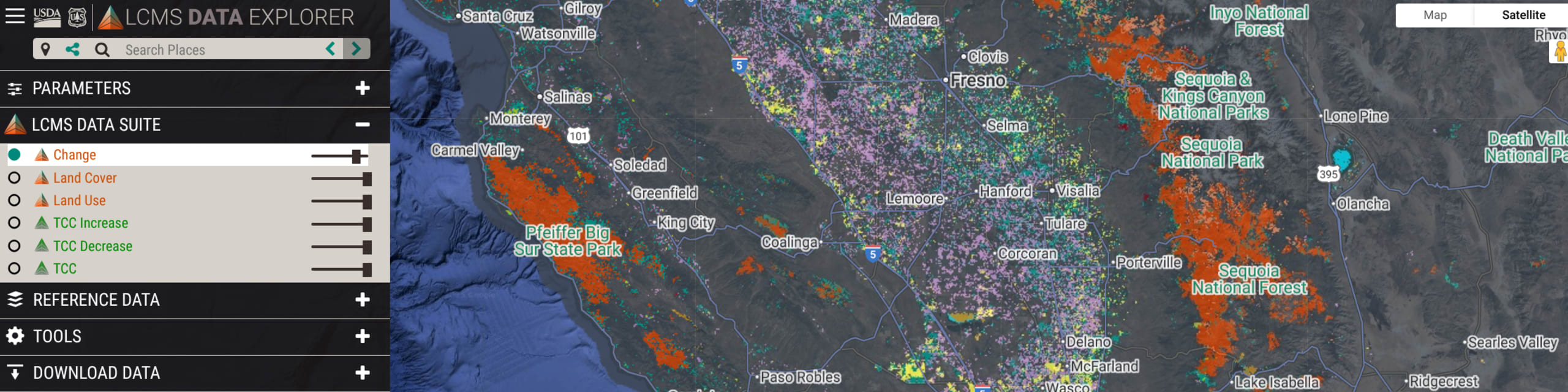
Learn how the Landscape Change Monitoring System (LCMS) leverages four decades of optical remote sensing data and predictive AI to provide information on landscape dynamics.
84 RSVP'd
Effective long-term management of natural resources relies on annual, nationwide maps of landscape change. The U.S. Forest Service's Landscape Change Monitoring System (LCMS) provides this critical data from 1985 to 2024, generating three complementary products: Change, Land Cover, and Land Use. This presentation will demonstrate how to synthesize these products using web-based data viewers to build a comprehensive understanding of landscape dynamics. Additionally, we will briefly explore the history of LCMS and how it has evolved to leverage Google Earth Engine (GEE) to facilitate custom satellite image processing, annual data updates, and the development of public-facing tools.
RedCastle Resources / United States Forest Service
Geospatial Specialist
Macquarie University
Macquarie University
The University of Queensland
University of Queensland
Science Catalyst Program Manager
University of Sydney
University of Sydney
Haizea Analytics
Managing Director
Contact Us
